pria.ee - Estonian Agricultural Register and Information Board
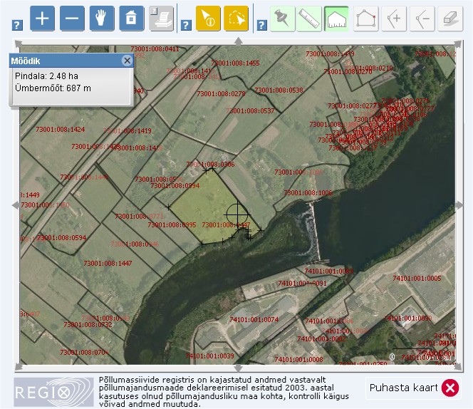
I haven't blogged for a while - really busy writing up my dissertation. However, I did come across a pretty nifty use of GIS in Estonia. My dad has business interests over there, and he uses the pria.ee GIS service to find out all sorts of things (click on the little map on the RHS). The Estonian Agricultural Register and Information board is the equivalent of a national land registry database, and it allows you to view a variety of data sets down to very fine detail. For instance, individuals land parcels can be viewed, and traced using measuring tools to identify distance or area (very useful for farmers to measure field sizes). Other data sets include the EU's Natura 2000, very high resolution aerial imagery and a raft of others that are listed in Estonian.

The GIS service can be accessed here and currently seems to be in Estonian only.
The GIS service can be accessed here and currently seems to be in Estonian only.
Labels: GIS
posted by Jan at
09:48
![]()


1 Comments:
it's good to see this information in your post, i was looking the same but there was not any proper resource, thanx now i have the link which i was looking for my research.
UK Dissertation Writing
Post a Comment
Links to this post:
Create a Link
<< Home