Sunday, 17 January 2010

The Third Bridge - Forth Replacement Crossing blog

I've recently launched The Third Bridge, which is a blog on the Forth Replacement Crossing. It really aims to do two things. First, it's my first foray into maintaining a site using the Wordpress CMS, and second it's a subject of personal interest living just a couple of hundred metres away from the old bridge and also the planned route for the new one. I'll keep the blog up and running for as long as I take an interest in the developments here - which I'm sure will be a while seeing it's right on my doorstep.

Depending upon how I get on with Wordpress, it may well be that this blog's content is moved across to a wordpress site too. I know I promised this a few weeks ago in an earlier post - but as yet I've not bought any hosting to support this.

Labels: ,

Thursday, 7 January 2010

Squeezebox wireless music player

Last year, following the sad death of my Imp wireless internet radio that I got back in 2008 due to a power surge, I decided to 'upgrade' to a digital music player or streamer as they are sometimes known. I did a fair bit of research in order to figure out exactly what I needed. In the end I plumped for the Logitech Squeezebox that I managed to get for around £140.

logitech squeezebox wireless music player

It's brilliant. Why? Well it basically plugs into any stereo system that has the ability to allow for audio in (any decent stereo will) and is then able to play either internet radio, mp3's from your host computer, or even dial into other content available on the internet. As my PC is on most of the time anyway, this means I have access to my entire music collection on my home stereo.

It also looks great. The little black box sits atop the stereo, and is essentially a large screen at the front, controlled through the remote control. The navigation system takes a little while to get use too: you navigate through the menus using the right arrow as next and the left arrow as back, but after a while it is actually very functional. But the best functions really are the search and the ability to shuffle your entire collection of mp3s. This makes it especially good fun when entertaining guests as you go from one extreme of your music collection to another.

Installation really is as straight forward as I make it sound. Plug it into the stereo, install some software on your home PC, fire it up, connect to the wireless network (it supports WPA encryption) and start using it. Connecting to your music library is pretty simple too, although for it to work perfectly a little effort is required. Why? Well, it uses the ID2 or ID3 tags in your MP3 files to catalog the music, so that it is searchable and browseable using the remote control and the music player. This meant I had to do a little bit of tedious sifting and editing of these tags using a freeware utility called mp3Tag. This lets you edit all your files quickly, preventing the oh so annoying duplicate artists appearing in the browse list because one has a capitalised letter someplace and the other does not!

There are alternatives of course - for example the very similiar offering by Phillips, the NP1100 is very similar at much cheaper, but is apparently not of the same build quality as the squeezebox. Nor is the supporting software nearly as good.

I'll post some further articles about it on here over time, including taking a look at the squeezebox families new offering - the squeezebox duet which is the newer version of what I have now.

Labels: , , , ,

Wednesday, 16 December 2009

Road traffic deaths map

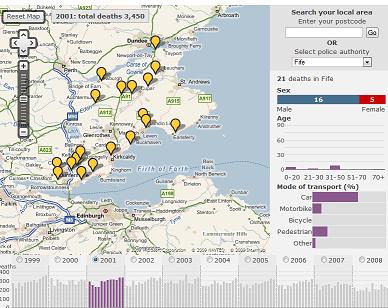
Today, something a little morbid - but a fascinating look at the use of 'free' online mapping to display a really interesting dataset.

road traffic deaths
The BBC have compiled a Road Traffic Deaths map. This allows you to map incidents of all road traffic deaths in your police authority, or in the area you are viewing on the google map. Ten years worth of data is included, and some pretty accurate point locations have been set for each of the deaths, certainly from those incidents I can remember. There is even some detail about the parties involved including age, sex and the type of vehicle. This data is displayed for the police authority on a bar chart to allow exploration of the demographic.

Labels: ,

Monday, 7 December 2009

We're moving!

OK - so I haven't blogged for, well, ages. The last year has been unbelievably busy and frantic. However I've rather missed blogging about this and that, so I've decided to resurrect this blog for at least a few months and see how things go.

First of all, I'm changing the slant of the blog slightly. It will still focus on much of what it did before. However the focus in particular is going to move closer towards available online sources of mapping and map data - rather than a particularly wide range of GIS type stuff it covered before. While I may cover all sorts of digital cartography related things, I think in particular I am interested in those that are also available as web services for use in other applications.

As a secondary focus, I am now living in South Queensferry. I love it here, and things are about to get even more exciting. A new Forth Road bridge is planned for construction over the next decade or so. It will be interesting to see what kind of 'new media' coverage there will be of this project.

Finally, I am hoping to move across to the wordpress platform. It's something I've toyed with for a while, but I've never really had the time to take the plunge. Don't get me wrong, blogger has been great for blogging, but I hope the new site will be much more than a blog - a categorised list of online cartography, digital maps, web map services and examples of the best mashups that tie all of them together.

So just to ease everyone in, today I saw posted on BBC News that the British Geological Survey has launched a website allowing free access to their repository of geological maps. Not only are there website based viewers, this one built on ESRI software, there are also KML feeds for use in Google Earth and Maps and even a free (for non-commercial use) WMS. Although admittedly this has been down for most of the day, presumably under heavy traffic from the BBC posting. Finally, and this is nearly unheard of from a public body, the entire dataset can be downloaded as digital map files in shape or tab file format for use in your favourite GIS.
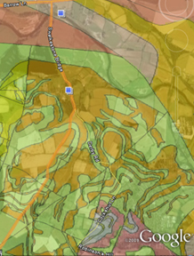
bgs screenshot
Of course, it's not all there yet - all of the detailed data down to 1:10k level is still only available under license and it won't surprise you that any off-shore data is not included. Still - I'd love to see this free data used in any examples.

Labels: , , , , ,

Sunday, 31 August 2008

Cycling resources around Edinburgh + Scotland

First of all - apologies for the lack of blogging. I moved house recently and it has taken a long time getting an internet connection back up and running. As ever, British Telecom were unbelievably frustrating to deal with. Useless customer advisors, ridiculous bureacracy, mistakes and sheer shoddiness.

Anyway, I now have a place to store a bike and I bought a new one a few weeks ago. I've never cycled in Edinburgh prior to this but had heard of some decent routes in and around the city. When I started using some of the tracks they exceeded all my expectations (although to be honest, these were quite low!). I live in the North of Edinburgh now, and my daily unmotorised commute takes me some 4.5 miles into the centre of Leith. The vast majority of this distance is on dedicated pedestrian/cycle paths part of a network of routes called the North Edinburgh Path Network. A useful brochure and map is available from cycleshops or on this PDF. These paths follow old railway lines across this area and allow you to get half-way across the city without encountering any motorised traffic. From Leith out to Cramond or to Murrayfield, along well-sign posted tracks. The city of Edinburgh council who look after the paths have also produced a further PDF showing additional cycling facilities in the area but resources are also available for other parts of Edinburgh and around.

This brings me neatly onto the wider picture. Sustrans is the country's leading 'Sustainable Transport' charity and has produced a series of maps that show some of the national cycling routes that exist. Their old site looks to run on an arcIMS application, which feels a bit old, but does contain a vast amount of detail. They also have a more modern version which uses Google Maps to show dedicated day routes. As you can probably imagine, this new site with the Google Mapping is much more user friendly, but sadly lacks the detail that the Sustrans main site does.

Over time I am planning to build up my own little collection of cycling routes and make these available on google maps or other mapping platforms. While the other sites are useful, I don't feel they provide nearly enough detail on how to get around, where you go when the dedicated path ends, and how to connect between the different routes. That isn't to beat them up too much - in fact, I think they are an excellent resource, and if cycling is promoted further we can force decision makers to improve the network even further.

Where do geoglobe's fit into this? Worry not, all these routes will be available within both your web browser and as KML. Now I've just to get cracking on them.

Happy cycling.

Labels: , , , , ,

Monday, 19 May 2008

A trip down to London city

I must have lived a fairly sheltered life so far. Nobody can believe that my trip two weeks ago to London was the first time I'd been there. Well it was and here are some photos to prove it!
Westminster Cathedral
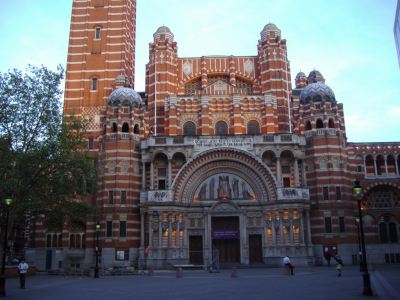
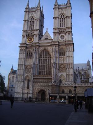
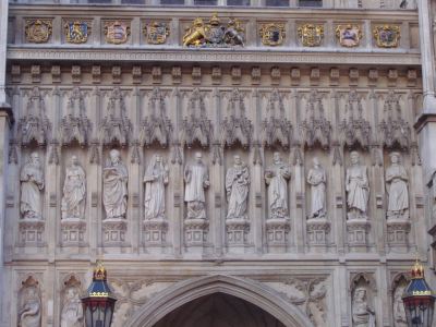
As part of my job, I deliver software training to mainly new clients. This particular client was based in Victoria, Westminster - right in the heart of the tourist part of the city. Above, Westminster Cathedral, located just along from Victoria station. Below the very impressive (and unbelievably huge) Westminster Abbey, together with a close up of the carvings above the entrance.
Westminster AbbeyWestminster Abbey Carvings
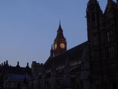
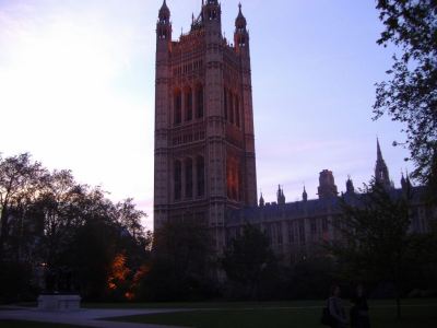
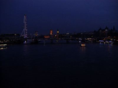
I was just down for a couple of days, so only had the overnight stay to work my way round the countless sights. I soon ran out of sunlight however, so apologies for some of these darker shots. Below, the first glance of Big Ben across the House of Lords, whereas the next shot is the familiar sight of the houses of parliament. Nope, didn't see anyone famous - just a lot of police!
Big Ben
Westminster

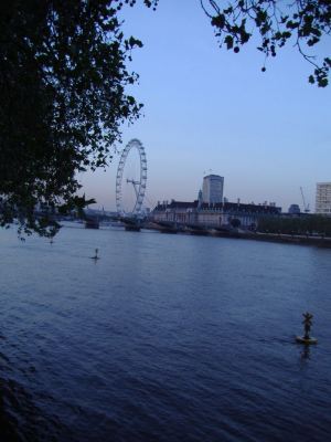
Couldn't make up my mind about the London Eye. It's a great landmark yes. Certainly catches the eye. But is it really neccesary with all the other fantastic sights around? Still, the Thames was impressive and I couldn't get over quite how busy it is on the river.
London Eye
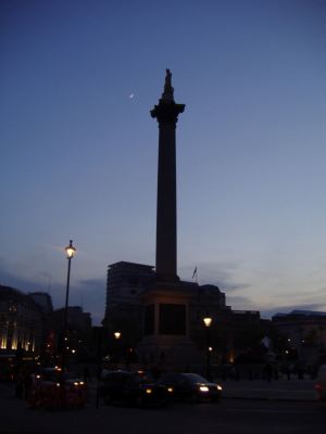
Nelson's Column, Trafalgar Square
So after wandering around the River, Big Ben, the Houses of Parliament and Westminster Abbey I headed up to Trafalgar square. Nelson's column above with the moon behind. Then from further afield in the dark, a slightly blurry shot of the night skyline where I had been earlier.
Sky at Night

The following day I got back home pretty late after a delayed flight (blame easyjet), but after a bit of a lie in, I decided to head out to the hills. Pictures of the very pretty Ben Lawers soon - although it was again unfortunately not ideal for photography. Must stop making excuses, and blog more! And start including some GIS related stuff!

Oh, better give sis a mention. She's now away out in Colorado on a course. Read all about it on her blog. If you can stand the colours of course! Gray!?

Labels: ,

Sunday, 20 April 2008

The views from Schiehallion

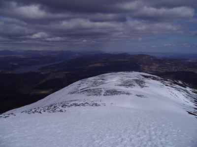
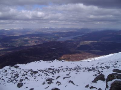
This weekend I needed to get out of the city so I went for a clamber up Schiehallion (1083m) up in Highland Perthshire, just North of Aberfeldy, overlooking Loch Tummel & Loch Rannoch.

Views across Schiehallion's ridge back to Loch Tummel

I'll leave the route description and map to Walk Highlands, although provided you find the Braes of Foss car park, you can't really go wrong on this one! It's a single path up and back down, quite direct and not too bad all around. The only slight obstacle facing us was the prospect of some snow and ice. I wasn't really equiped for dealing with ice, so I went up with the intention of just going as far as I could manage. As it turns out the snow was fairly fresh and soft and really wasn't too hazardous at all, and was only really an issue for the last 500-600ft of the climb.

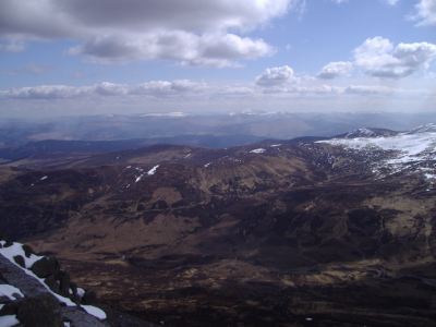
views North with the River Garry below

While Schiehallion is one of these slightly annoying mountains where you never get a good view of the summit, except from right at the start, you do absolutely stunning views back behind you to Loch Tummel, and better still South towards the Ben Lawers massif. Once you hit the top, Loch Rannoch also reveals itself, with the high peaks of the Cairngorms in the distance to the North (above), and those of Glen Coe in the West.

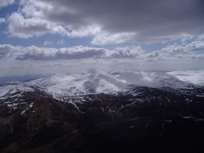
The Ben Lawers massif looking South from Schiehallion

Ben Lawers can be seen in the photo above, whereas Loch Tummel can be viewed below. I also did a quick KML, that should have the photo locations embedded. Or see a 360 degree movie from the summit!

Views across Loch Tummel
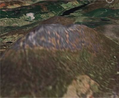
Below, roughly the view from Google Earth.

Views across Loch Tummel

Away from the photos, there is some prominent history behind Schiehallion. It was used by Nevil Maskelyne to calculate the mass of the earth, on the basis of knowing the mass of the mountain (it could be accurately calculated being such a conical shape) and the first mountain to be mapped using contour lines. General info on wikipedia and Munro Magic as ever. Better still, its name is used by a brewer for a rather tasty ale.

Labels: , , ,